

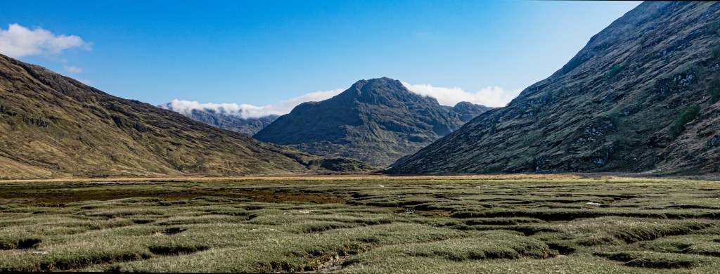
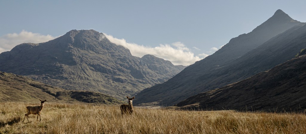
I’m astonished. Apart from a couple of brief resurfacings, I sleep long and well. Gaby’s gentle breathing is reassuring. She’s still asleep as I quietly extract myself from my sleeping bag. It’s seven o’clock, which is already becoming my usual wake-up time. Outside there’s much more astir, tea a-brewing, quiet morning conversations. The sun hasn’t reached us yet, but violent shafts of light are piercing their way through yesterday’s sleeping mountains, turning the ground at the far, eastern end of the loch a buttery yellow. The deer have gone, perhaps because the tide is coming in.
I wash my face in a trickle of a burn beyond the western end of the bothy, collecting more in my water bottle at a glacial pace. The easiest place to get it isn’t moving very much, which doesn’t matter when I’m boiling it for porridge. But I’m a bit worried about my drinking water. This isn’t something you normally have to think about in the north-west highlands, but it hasn’t been a normal spring.
Gaby sits up when I go back in. She slept well too. I make my porridge and go outside to eat by the loch, smiling good morning to Sarah at her tent. The light is already moving towards us, banishing the shadows. I’m looking forward to today, venturing into the infamous Rough Bounds of Knoydart where commandos used to train and maybe still do. But it’s a relief that Sarah is going that way too. I chat with an older Dutch couple who are already packed up and ready to go on to Inverie. They are so friendly and interesting, so pleased to be on their adventure, I wish I’d had the chance to speak with them last night.
I go back inside to start clearing up. I’m still bundled up in my fleece, but as soon as the sun strikes, it’ll be a different story. Sarah comes in. She wonders if the tide is still far enough out to walk round the shoreline. Maybe. But she’s probably right that it’s not worth the risk of getting so far along, only to have to come back and go up over the end of the peninsula behind the bothy.
I start packing, suddenly worried I’ll hold her up. A sleeping bag put out to air by one of the campers begins to take off, so I shout a warning. It’s a strange experience, this getting ready for our various adventures. Last night we were eager to become familiar with each other, like hermit crabs trying to crowd into the same shell. But now each of us is pulling away, making ready with our own rituals for a new day with new experiences and people to meet. I fill my bottle again, but hope I can find another, faster-flowing river before I need to drink from it.
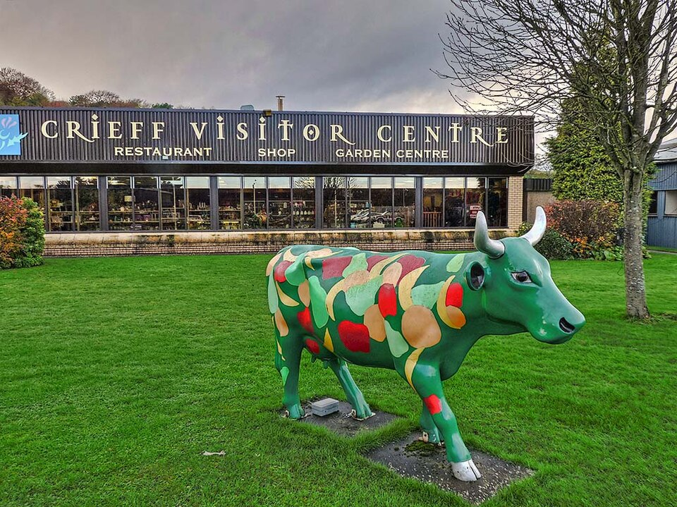
The shadows of the past are moving too. A serving girl, perhaps, still half asleep, stumbling into the new day to draw water in the same stream as we are. Or a herd, stooping to throw some water over his face, as I’ve just done, before heading off to look after his shaggy charges. There were five tenants here at Sourlies for the first survey in 1748. Three of them – John Kennedy, John Gillies and Donald Gillies – came to ‘Barrisdale’ (meaning Inverie) to report to the surveyor on 7 November. They told him Sourlies was a half pennyland for which they paid in rent between them roughly £671 a year in today’s money, as well as various taxes. The other two tenants – William Gillies and John McDonald – were said to be ‘just now from home.’ Perhaps they were drovers attending the annual cattle tryst at Crieff over 120 miles away where up to 30,000 beasts would spread out around the town every October.[i]
Seven years later, in 1755 – in a survey conducted partly here at Sourlies – there were only two families left, the tenants named as William and John Gillies. The total inhabitants numbered ten – one boy, three adolescents and six adults[ii] – around the same number as slept in and around the bothy last night. Four were able to spin, which presumably meant all the women, and one spoke English, which was most unusual (perhaps William Gillies, if he was indeed a drover). Between them, the two families kept four horses, twelve black cattle, ten sheep and ten goats, the sheep and goats presumably providing the wool for spinning.
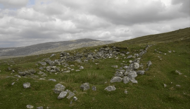
On the map produced alongside the survey, two little rectangles suggest two houses at Sourlies, one for each family. In 1755 and well into the nineteenth century, the tenants’ houses were built in the old way, a wooden frame covered over with turf or peats or wattle-work (creels). Some of the animals may have lived in one end, separated from the human occupants by a wattle screen. These houses were cosy, certainly. But they were also fantastic places for breeding insects and disease.
And for all Mungo Campbell’s criticism of the McDonnells of Barrisdale, these tenants were now paying nearly double the rent – around £1197 in today’s money – they’d given to Coll and then Archibald only a few years before. Perhaps fairness had gone out of the window as the cost of Britain’s almost endless overseas wars began to bite, and Mungo himself had left to fight in some of them.
The two Gillies families managed, somewhat remarkably, to coax two acres of tillage (presumably barley or oats, given the indifferent soil quality) and four acres of hay out of this rough ground, as well as sowing potatoes, using ‘sea wreck’, the pasta-like strips of seaweed clumped across the shore, as manure. The lumps and bumps – all that remain of these lazy beds – can still be seen along the lochside to the west of the bothy. But that was more about self-sufficiency than profit, leaving the black cattle and perhaps some of the sheep to shoulder most of the burden of generating income.[iii]
In the next survey (1772), there were still two tenants at Sourlies, Donald Macdonald and John Gillies, who between them were allocated thirty-one soums of black cattle, including twelve milk cows. Souming was used throughout Scotland to ensure – in theory at least – that a particular pasture could feed a set number of animals. Unfortunately we don’t know how many cows and bulls made up a soum in Barrisdale – it seems to have ranged from between four and ten, meaning there could have been over 300 beasts on these hills. They also had 30-35 sheep and 30 goats between them, which is all significantly more than the tenants had in 1755.
Like their predecessors, they had their shielings too, the temporary shelters replenished each summer so that all those not needed to look after the crops could take the beasts there to graze on grass not munched to the bone in winter. One of Sourlies’ shielings was at Lagandie, which lay up near the border with Glen Dessary, perhaps near where the chiefs’ boundary stones are. The other was in Coire na Ciche, which lies behind Druim nan Uadhag, the hillside on the north side of the Màm na Cloich’ Airde.
The surveyor was certainly pleased with the quality of the Knoydart beasts: ‘With respect to the cattle in this country, it is generally allowed that they have a good breed of their own… And they draw as high prices for their cattle as any other adjacent country except that of Kintail notwithstanding the great distance from Market which is held at Fort William. The cows at an average will weigh from 14 to 18 stone sell from 40 to 50 shillings per head [c.£360 now].’ That would explain the increase in rents, then, hand in hand with the increasing numbers of cattle roaming the nearby hills.
But it certainly wasn’t easy and every year the tenants lost one or two through ‘bone breaking’ on the rocky ground they had no choice but to graze them on. Having seen the walls of rock, the skittering stones, as I came down from Glen Dessary yesterday, I’m really not surprised. No wonder they drank whisky. The people. Not the cows.
The surveyor must have been sent north with instructions to see what more could be squeezed out of the ‘king’s tenants’ in rent. Admittedly, Sourlies currently paid £5 10s or around £950 today, £247 less than in 1755. But the government wanted another £477 (£3 then), bringing it up to a whopping £1427. Sure, cattle prices remained buoyant. Donald Macdonald sold three cows a year for 2 guineas (£363) a head, while John Gillies sold ten cows in three years at a mighty 50 shillings a head (£431), providing Macdonald with an annual income of around £1089 and Gillies with more than £1239.
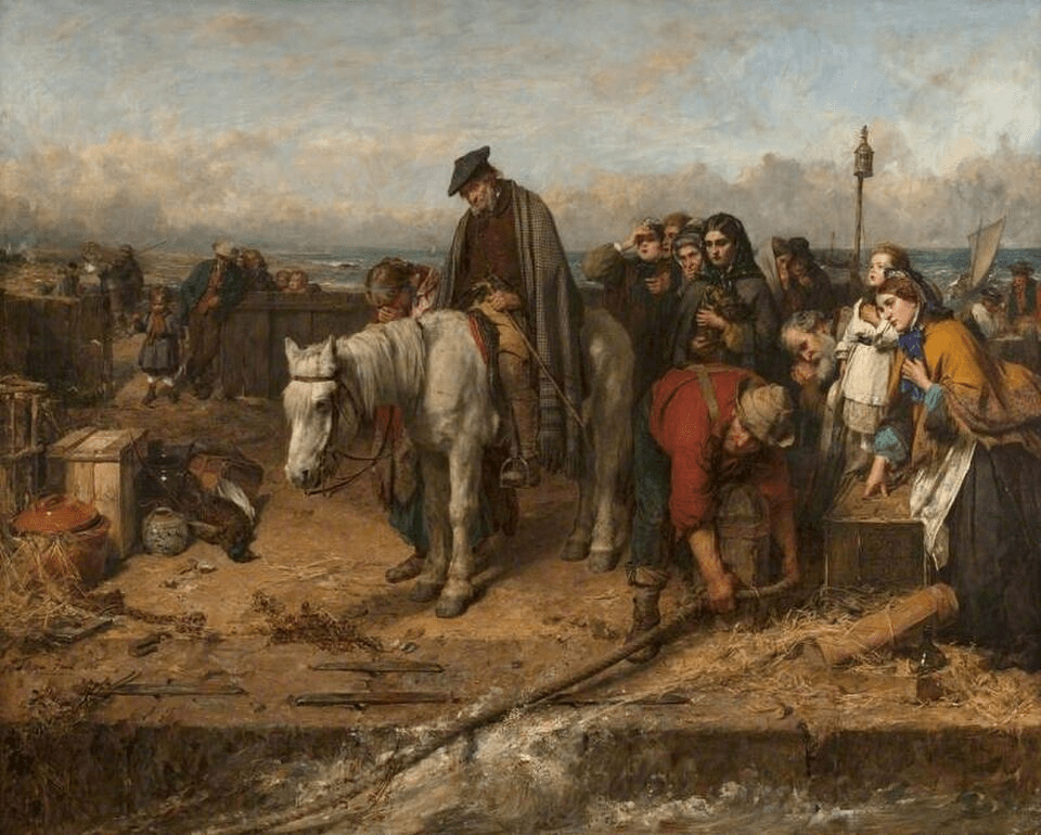
But that doesn’t take their costs into account. For a start, Macdonald employed three servants (a man, a maid and a herd), whose wages amounted to nearly £400 a year. The surveyor pleaded with the commissioners not to demand more in rent. ‘I am humbly of opinion that the additional proposed is as much as they can bear, at least for some years. To lay a high additional rent upon them at once would certainly dispirit them, and tempt them either to grow desperate in the country, or like their neighbours to emigrate to America which I apprehend is quite opposite to the intention of the honourable board.’[iv]
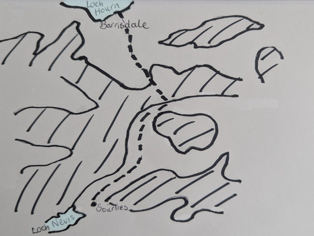
And yet, reading all my copious notes from the record office, it strikes me that at least the families living here at Sourlies – or Sorious, as it was usually written then – were not on their own but formed part of a much larger community stretching along the coast and up into some of the glens. For those of us here today, there really is just us, the great metropolis of Inverie lying some ten miles away, hidden behind a headland. Given how far you have to walk to get here (unless you can persuade a local boatman to bring you in from the other side of the loch), the bothy is the very definition of isolated. As one blog describes it, ‘As remote as it gets. Knoydart is the remotest part of Scotland, while Sourlies is one of the remotest named places in Knoydart.’[v]
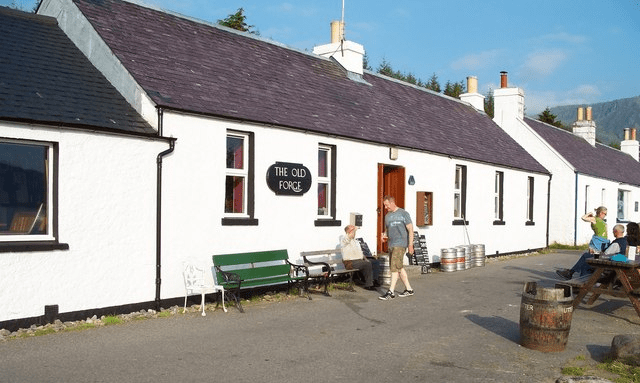
But 150 years ago, immediately to the north – where Sarah and I will soon pass through – lay part of the township of Carnoch, along with the separate township of Achagline. Across the other side of the River Carnach heading west was Torcruin, with more townships beyond all the way to Inverie. In 1755 there were 25 families living on the Loch Nevis side of the Barrisdale estate, amounting to 155 people in total. The gender balance was remarkably even – 78 males; 77 females. Not surprisingly, Inverie was by far and away the biggest township, with 7 families and 47 people, not to mention the change house or small inn. That seems only right and proper, given that Inverie is famous now for being the home of the ‘most remote pub on mainland Britain.’[vi]
But in case you were worried that the people of Sourlies lived too far away to enjoy a dram or two, fear not. They had their own whisky house, presumably run out of one or other of the two buildings marked on the map. Needless to say, the availability of hard liquor did not meet with Mungo Campbell’s approval. He noted in 1755 that ‘the multiplicity of whisky houses is one great means of the poverty of the inhabitants.’[vii] My dad would certainly have agreed, and perhaps they were right. But it strikes me as a bit too glib, this rushing to judgement of those whom, let’s face it, they held in low esteem, highland culture and habits deemed old-fashioned at best, uncouth and immoral at worst. And other than when they were telling the surveyors, presumably through an interpreter, what rent and dues they paid, the people of Sourlies, like their neighbours, have no voice in the historical record. So I would rather not jump to conclusions.
A century later, life at ‘Surlies,’ as it was now named, had become very different. The cattle had gone – replaced by bigger, whiter breeds of sheep than the native ones – and so had most of the people. In 1876 the Ordnance Survey map showed ‘Two roofed dwellings and an area of cultivated ground.’ It was described as a ‘shepherd’s dwelling … nearly opposite the sheep farmer’s dwelling at Finiskaig (to the south on the other side of the Finiskaig river).’ The sheep farmer’s house is still there, along with the outline of the stone walls that presumably enclosed the sheep when they needed sheared or dipped.
The 1881 census gives us, for the first time, the name of the woman of the house at Sourlies, Elizabeth Mackenzie, along with those of her four children, Catherine (aged 12), Janet (aged 9), Hector (aged 6) and little Alexander (aged 3). Her husband, the shepherd, must have been away from home the night the census was taken, so we don’t have his name. It must have been hard, living out here almost by yourself, especially with young children, though no doubt the older girls would have looked after the wee boys. Presumably, too, the farmer at Finiskaig was her husband’s boss, so any socialising would not be done on an equal footing. By 1902 there were three buildings at Sourlies, along with a garden and an enclosed field.[viii] The current bothy with its stone walls and tin roof is presumably one of them, though I wonder if it was Elizabeth’s home too. There’s no sign of the garden, though dark green patches might mark the outline of the field.
But for all the detail provided to the Forfeited Estates Commissioners, the names to be found in the census, it’s impossible now to feel what life was like, whether it’s a century ago or more than two. Lives lived are only superficially about numbers of animals or acres of crops, the delineation of a building or a field, the pathways taken, even names noted down. As with the conversations I had last night and this morning, it is the intangible things that truly flesh us out, the chat in the whisky house, the gossip brought by the drovers, the stories recounted as folk worked, the glances exchanged at the meagre harvest or digging the peats, the songs sung to make a hard day’s work a little lighter. And for that, we mostly have only our imaginations.
I’m ready for what is, on paper at least, a comparatively easy day of just over nine miles (15 km) of walking. But I’m pretty sure it’s not going to be that easy, not in this rough, mountainous land. I say goodbye to Gaby, wishing her well. Not that she needs it. She oozes competence, for all her gentleness. I have no doubt that, if she decides to do it, the Cape Wrath trail will be hers for the taking. I turn, looking for Sarah. Her tent is gone. And so is she. Oh! But there was no reason for her to wait. She knows I know where she’s going. I set off up the steep track behind the bothy and move easily, up and down small ridges and gulleys, Sarah sometimes silhouetted on the skyline, before descending into the great flat valley of the River Carnach.
Above me a series of tremendous peaks rise unapologetically straight out of the valley floor. The most dramatic, with its brazenly symmetrical summit pointing to the sky like a space rocket ready for take-off, is Sgurr na Ciche (which translates, somewhat underwhelmingly as the ‘conical hill’). The ground crunches slightly beneath my feet, everything tinderbox dry. Though a patchwork of greens, from emerald to olive, stretches away from me, the tops of the grasses have been bleached to a dirty blonde. The tide doesn’t reach this far, but what lies in front of me is still a floodplain, not of Loch Nevis, but the River Carnach which lies some distance away on the far side. Right now it’s hard to imagine this as one great semi-saturated expanse of water, the pockets of grasses and mosses squelching instead of squeaking. Scotland is become a different country in such enduring sunshine. I tell myself we’re owed it – last year was truly miserable, there were hardly any butterflies, and we didn’t get any of the tomatoes Nick grew in the greenhouse until October. The rain will come, because it always does, no matter how dry the spring. But what if it doesn’t? Then we really will be in uncharted territory.
Sun-queen that I am, I can’t help luxuriating in the intense brightness. A few fluffy clouds, brilliant white against brilliant blue, cosy around the shoulders of Beinn an Aodainn. But I doubt they’ll last long against the sun’s gathering ferocity. I’m glad I decided to bring sunscreen as moisturiser or there would be nothing to stop me desiccating as vigorously as the grass, which is most unwise at my age (or, indeed, any age). A few deer nibble nearby, presumably some of those I saw on the beach yesterday who’ve moved round the headland for fresher fare, though they will have to rummage hard to find any of the usual tender shoots of spring.
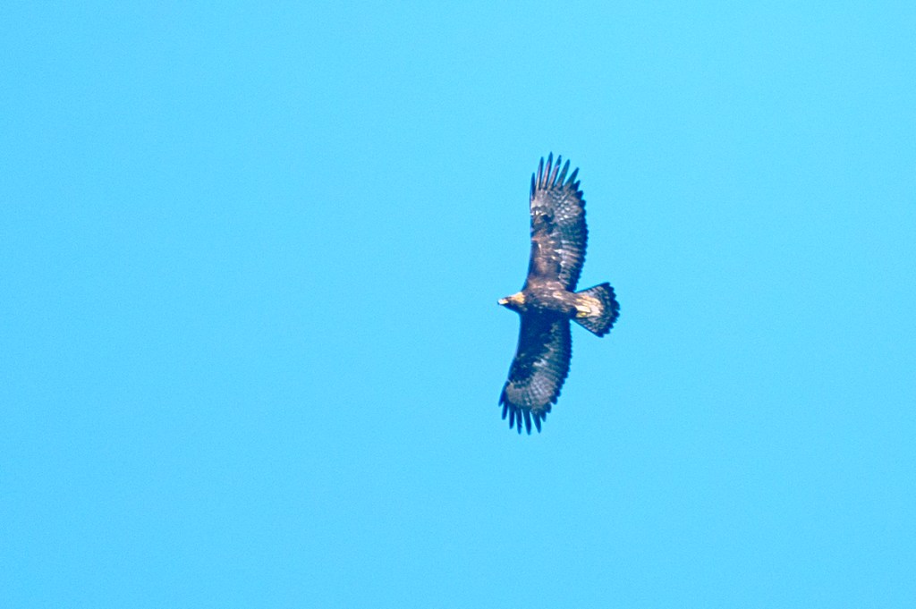
A bird of prey drifts high above me, too far away to identify. It could be a golden eagle or even a sea eagle, those glorious predators of the high tops. Revered since at least Pictish times, such magnificent creatures were occasionally used to hunt larger game, including foxes and deer. But by the eighteenth century, they became prey themselves as tenants whose rents were rising fast worked to squeeze maximum profits out of the lambs and even new-born calves that might be snatched in the birds’ lethal grip.[ix] I wonder what it’s like away up there, soaring through clear skies. Even the view from the top of Sgurr na Ciche would be mind-blowing, a jumble of mountains clamouring for immediate attention before the gaze is pulled towards glinting smudges of water before finally settling onto the sea and the distant Hebrides floating on the western horizon.
[i] John Macky, A journey through Scotland : In familiar letters from a gentleman here, to his friend abroad. Being the third volume, which compleats Great Britain (London, 1723), p.194
[ii] The adolescents were two male and one female aged between 10 and 17. The adults were split equally between men and women.
[iii] https://www.trove.scot/place/375709#details; GD50/2/1
[iv] GD50/2/1
[v] https://www.mudandroutes.com/place/sourlies-bothy/
[vi] E729/3/6; https://highlandguide.co.uk/locations/inverie/
[vii] E729/1
[viii] https://www.trove.scot/place/375709#activities
[ix] https://www.nts.org.uk/stories/the-golden-eagle-the-true-bird

Leave a comment